
My Travel World
Read our comprehensive review of My Travel World, the premier travel mapping app for Mac. Track your global adventures, map visited cities, and view stats.
Visualize Your Global Adventures with My Travel World
For avid globetrotters, keeping track of every journey can be a challenge. My Travel World travel mapping app offers Mac users a sophisticated desktop solution to document, catalog, and analyze their global travels. Developed by Horst Jehle, this application serves as a digital travel diary that transforms your past vacations, business trips, and weekend getaways into interactive visual maps and detailed statistics.
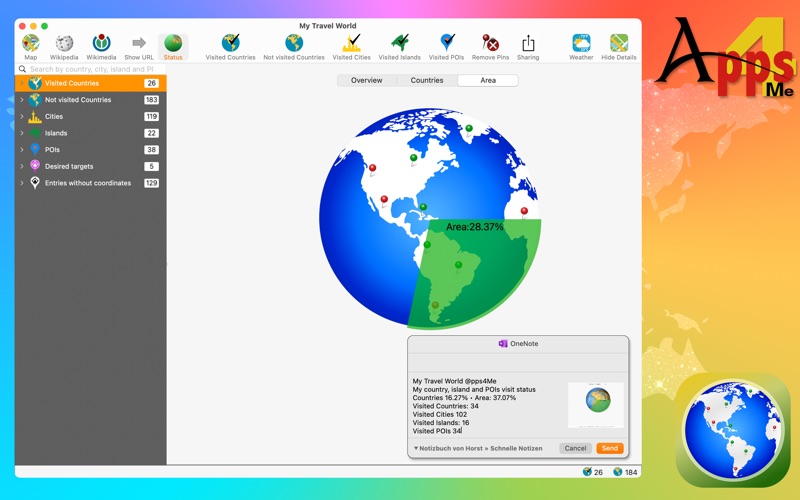
Unlike simple mobile trackers, this macOS application is designed to leverage the screen real estate of your desktop or laptop. It provides a highly detailed overview of your travel footprint, calculating the exact percentage of countries you have visited and even the proportion of the Earth's surface you have covered.
Comprehensive Mapping and Pinpoint Accuracy
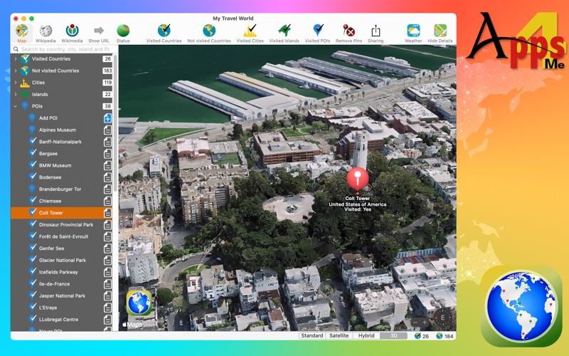
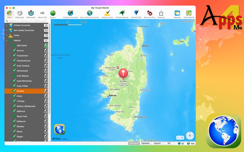
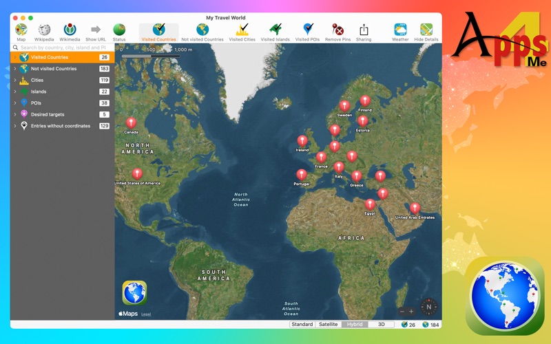
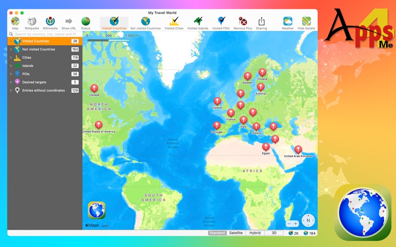
The core experience of using the My Travel World travel mapping app revolves around its versatile map display. Users can toggle between Standard, Satellite, Hybrid, and 3D map views to see their journeys from different perspectives. Whether you want to view a broad overview of visited nations or zoom in on specific coordinates, the software handles the details seamlessly.
- Multi-Level Tracking: Pinpoint not just countries, but specific cities, islands, and custom points of interest (POIs).
- Precise Coordinates: Manually enter longitude and latitude for POIs to ensure your map pins sit exactly where you want them.
- Visual Customization: Display maps showing visited locations, unvisited areas, or specific desired destinations for your next big trip.
In-Depth Travel Statistics and Country Data
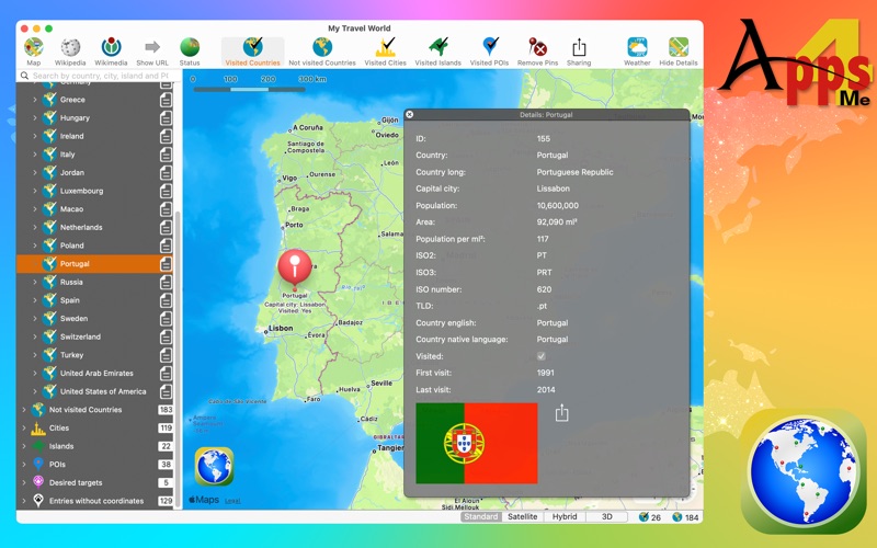
One of the standout features of this utility is the depth of data it automatically associates with your travels. When you select a country, the app provides instant access to official statistics and useful geographical information. You can view capital cities, total population, land area, ISO codes, and even local weather details like sunrise, sunset, and current temperatures.
Additionally, the app automatically generates quick-reference links to Apple Maps, Wikipedia, and Wikimedia for every selected destination, making it an excellent research tool for future planning.
Data Export and Sharing Features
Your travel history is valuable, and this software makes sure it is never locked away. Users can easily export their complete travel lists, including first and last visit dates, custom notes, and postal codes. Data can be exported into standard formats like TXT, XLSX, or DOCX, making it easy to back up or use in external spreadsheets. For social sharing, you can quickly generate shareable graphics of your visited maps or text-based statistics to send to friends via email, AirDrop, or social media platforms.
Who Is This Desktop Tracker For?
If you prefer organizing your life and memories on a spacious Mac interface rather than a cramped smartphone screen, this tool is built for you. With full support for macOS Dark Mode, Retina Displays, and full-screen presentation, it fits beautifully into the Apple desktop ecosystem. It is ideal for digital nomads, retired travelers, and geography enthusiasts who want an organized, analytical archive of their lifetime achievements abroad.
To start mapping your personal journey and analyzing your global footprint on macOS, head over to the official Mac App Store to explore the details of this premium travel companion.